
We have had so many of our friends and family ask us where to go find some of ” the cool waterfalls ” we hike to in the Sipsey Wilderness area / Bankhead National Forest. This has become my go to spot to send people for their first Sipsey experience. There are many other areas to go that are more off the beaten path and down dirt roads, but this is a great starter. One reason is the trailhead is located at the only really nice parking area with an actual bathroom ( a vault toilet ), no nameless rough dirt roads to traverse, and A fairly quick hike that gets you to multiple beautiful falls.
Getting There
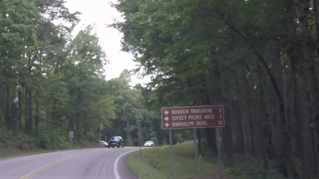
From Double Springs, AL, Drive north on Hwy 33 for Approximately 12.5 (ish) miles. To Cranal Rd ( Also shows up as CR 60 on maps). You’ll know you’re almost to it when you see the brown sign with arrows to Borden, Sipsey Picnic, and Randolph Trailheads.
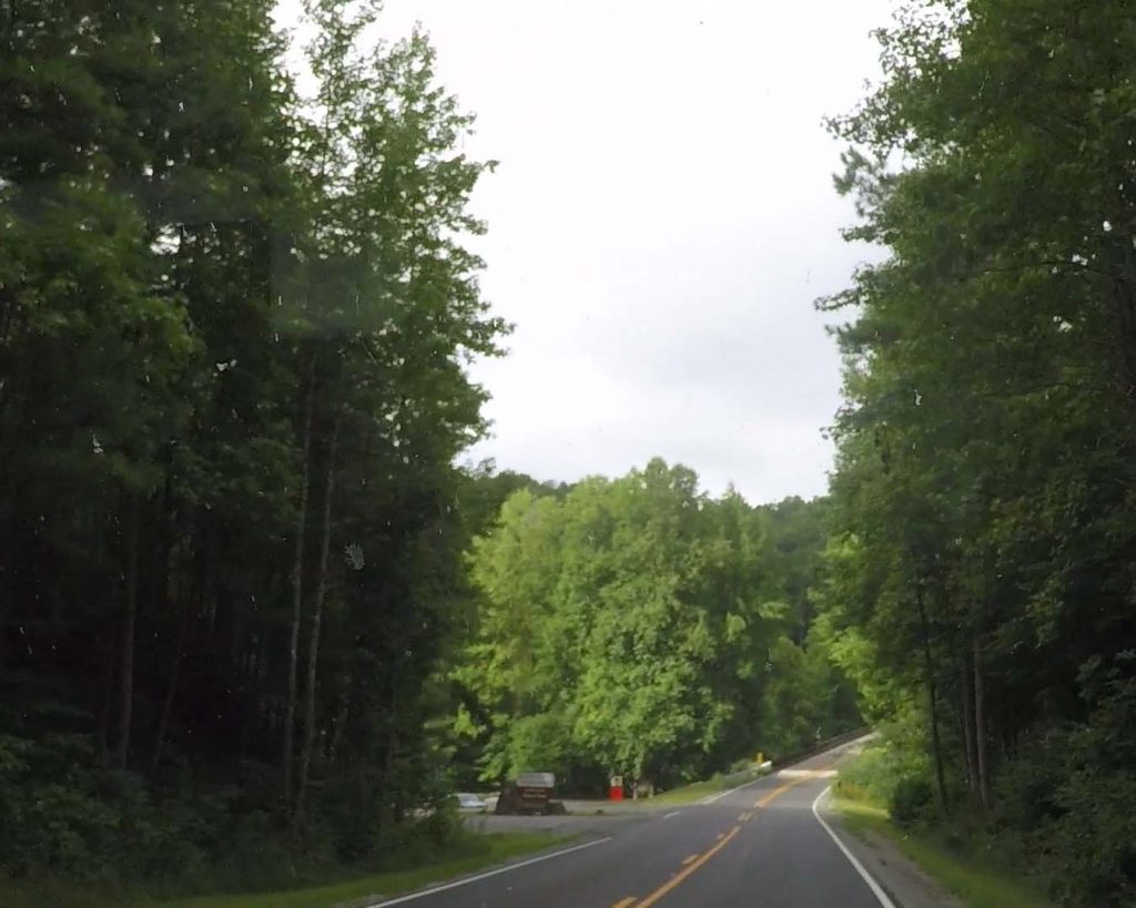
After making this really awkward left turn ( It’s a really weird Y ) , You will drive 3.5 to 4 miles to the Parking area on the Left. It can sneak up on you, so just know that you’ll be going down hill towards the bridge that crosses the sipsey river. The parking area is just before you cross the bridge. The sign is kind of hidden until you are almost to the driveway.
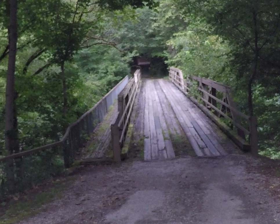
There is a $3 use fee. ( check or cash ) The pay box and envelopes are near the bathroom at the upper lot. There is an upper and lower parking area. The upper one can get really filled up on weekends. To get to the lower one, just drive across the one lane bridge. The trail for this hike is actually from that lower parking area anyway. Plus driving over the bridge is kind of fun. 🙂 We always stop and fill out our envelope and pay before we drive down to the lower lot. (Bring a pen. Sometimes the one at the paybox is missing.) Sometimes its so full up there we just park and walk back up there. ( If you do this, remember to get your TAG number!) HAHA! Save yourself multiple trips.
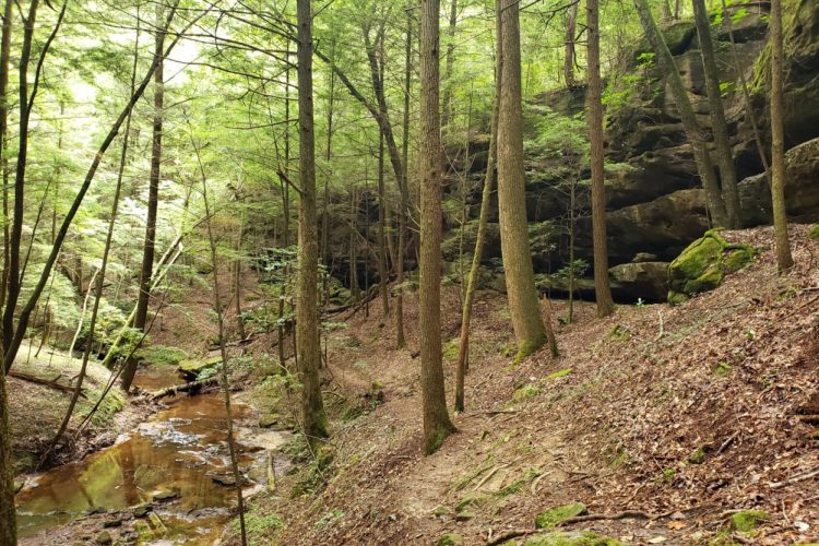
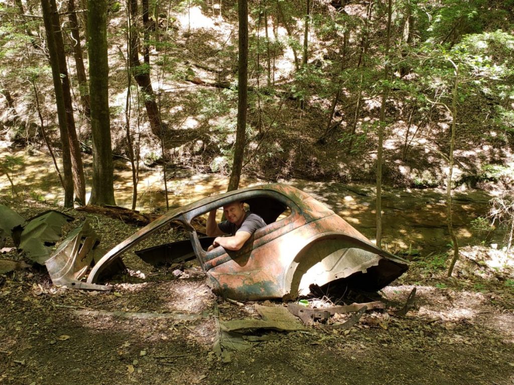
To find the trail, walk up towards the bridge you drove over. You will notice a sign like a trailhead bulletin board. This has been totally empty when we have hiked there. The trail starts here and leads down hill and under the main Rd above you. The fun begins! One of the interesting things you will come upon is an old wrecked car from Decades ago that crashed off of old Cranal Rd. This is said to be a 1936 Ford. From what I’ve read, the car came off a bluff of about 40 ft, but the passengers were ok, thankfully. It’s a very fun photo spot.
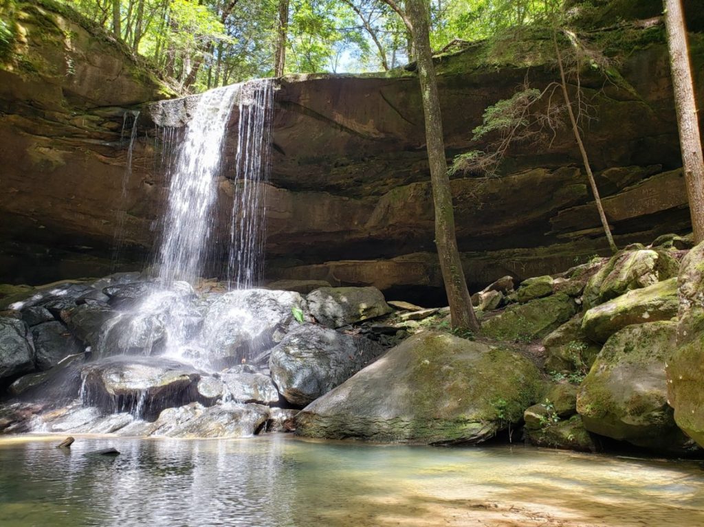
Soon you will come to Turkey Foot Falls. It’s only around a half mile hike from the trailhead. It’s a great spot for photos, sticking your toes in the water, having a snack, etc.
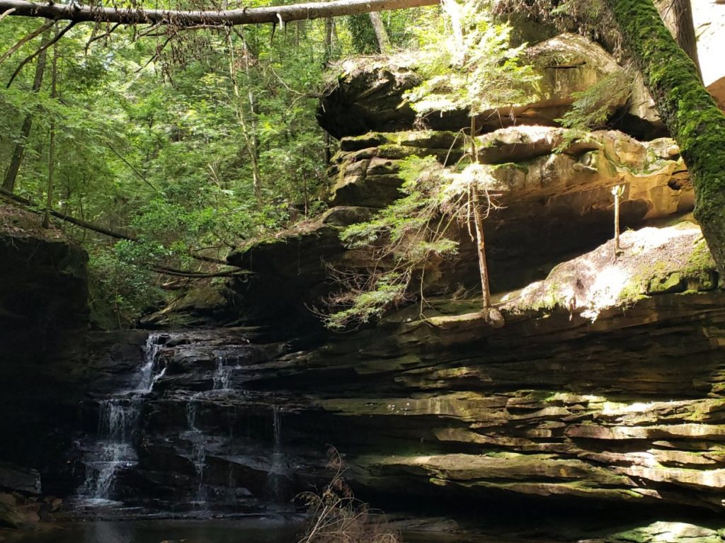
Mize mill falls is only about 300 more yards up the creek. There are 2 options, 1 is to stay on the trail you have been walking on. This is not the way I recommend because it leads you up above the falls and the only way down is a super sketchy scramble that involves a rope. The other way is to cross the creek while you are at Turkey Foot falls. It’s usually just a simple hop and skip across some rocks. The trail on that side of the creek will lead you to the bottom of the falls where all the good picture taking is anyway. It also doesn’t involve a sketchy scramble.
Simply retrace your steps back to the parking area when you are done. Easy, Peasy! There are more hikes to do from that parking area. 1 more in that lower parking area, and 1 in the upper parking area. I will write more on those in other posts.
Tips
- Gas up, snack up – This is pretty far out in the middle of nowhere. Double Springs is a good spot to get stocked up for your drinks, snacks, or picnic stuff. There is a grocery store, Dollar General, gas stations, and if you just want to eat, there is a subway, Jacks, and a Mexican restaurant. ( We sometimes find ourselves inhaling some fajitas after a long day of hiking. )
- GPS – The cell service is spotty and/ or non existent once you get out towards the wilderness area. Study the map and directions before you leave just in case you suddenly can’t get your phone to tell you where you are going. We also recommend using an app such as Gaia GPS. You can have the area you are going to hike/ drive downloaded into your maps, and that allows you to still be able to see where you are on your gps when your cell service is gone. It also allows you to set waypoints, and add pictures to your hike, etc. Alltrails is another popular app for this.
- Wear good shoes. This is not a simple, flat, rock-free path. I don’t recommend flip flops, or you may have a blowout.